Category:Black and white photographs of Utah
Jump to navigation
Jump to search
States of the United States: Alabama · Alaska · Arizona · Arkansas · California · Colorado · Connecticut · Delaware · Florida · Georgia · Hawaii · Idaho · Illinois · Indiana · Iowa · Kansas · Kentucky · Louisiana · Maine · Maryland · Massachusetts · Michigan · Minnesota · Mississippi · Missouri · Montana · Nebraska · Nevada · New Hampshire · New Jersey · New Mexico · New York · North Carolina · North Dakota · Ohio · Oklahoma · Oregon · Pennsylvania · Rhode Island · South Carolina · South Dakota · Tennessee · Texas · Utah · Vermont · Virginia · Washington · West Virginia · Wisconsin · Wyoming – Washington, D.C.
Guam · Puerto Rico · United States Virgin Islands
Guam · Puerto Rico · United States Virgin Islands
Subcategories
This category has the following 6 subcategories, out of 6 total.
D
Media in category "Black and white photographs of Utah"
The following 200 files are in this category, out of 369 total.
(previous page) (next page)-
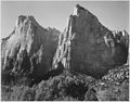
 "Court of the Patriarchs, Zion National Park," Utah, 1933 - 1942 - NARA - 520019.jpg 2,000 × 1,560; 979 KB
-

-
 Mountain Dell Dam near Salt Lake City Utah.jpg 1,024 × 862; 142 KB
-
_(2).jpg/120px-1_oldest_(2489562113)_(2).jpg) 1 oldest (2489562113) (2).jpg 2,849 × 2,327; 3.18 MB
1 oldest (2489562113) (2).jpg 2,849 × 2,327; 3.18 MB
-
_(2).jpg/120px-10_newest_(2489562465)_(2).jpg) 10 newest (2489562465) (2).jpg 2,377 × 1,604; 2.09 MB
10 newest (2489562465) (2).jpg 2,377 × 1,604; 2.09 MB
-
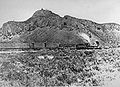 First Transcontinental Rail.jpg 871 × 628; 48 KB
-

-
.jpg/120px-1924._Cedar_Breaks_National_Monument._Utah._(38189678972).jpg) 1924. Cedar Breaks National Monument. Utah. (38189678972).jpg 1,928 × 1,178; 308 KB
1924. Cedar Breaks National Monument. Utah. (38189678972).jpg 1,928 × 1,178; 308 KB
-
.jpg/74px-1924._Cedar_Breaks_National_Monument._Utah._(38189681222).jpg) 1924. Cedar Breaks National Monument. Utah. (38189681222).jpg 1,154 × 1,859; 294 KB
1924. Cedar Breaks National Monument. Utah. (38189681222).jpg 1,154 × 1,859; 294 KB
-
.jpg/120px-1924._Kanab%2C_Utah._(38189672122).jpg) 1924. Kanab, Utah. (38189672122).jpg 1,868 × 1,157; 231 KB
1924. Kanab, Utah. (38189672122).jpg 1,868 × 1,157; 231 KB
-
.jpg/120px-1924._Kanab%2C_Utah._(38189674582).jpg) 1924. Kanab, Utah. (38189674582).jpg 1,865 × 1,190; 286 KB
1924. Kanab, Utah. (38189674582).jpg 1,865 × 1,190; 286 KB
-
.jpg/74px-1924._Kanab%2C_Utah._(38189676732).jpg) 1924. Kanab, Utah. (38189676732).jpg 1,139 × 1,835; 237 KB
1924. Kanab, Utah. (38189676732).jpg 1,139 × 1,835; 237 KB
-

-

-
 1950 Vacation to Bryce Canyon National Park, Utah.jpg 1,496 × 2,120; 601 KB
-
-
 A study among the rocks of Echo Canyon. Summit County, Utah - NARA - 516641.jpg 3,000 × 2,395; 1.94 MB
-

-
 Alex Pickering van.jpg 682 × 505; 251 KB
-
 American Canyon, Utah - NARA - 519520.jpg 3,000 × 2,282; 1.74 MB
-

-
 Ansel Adams - National Archives 79-AA-V01.jpg 3,000 × 2,340; 1.01 MB
-
 Ansel Adams - National Archives 79-AA-V02.jpg 2,162 × 3,000; 815 KB
-
 Ansel Adams - National Archives 79-AA-V03.jpg 2,406 × 3,000; 869 KB
-
 Ansel Adams - National Archives 79-AA-V04.jpg 3,000 × 2,385; 1,012 KB
-

-
._Old_Nos._390%2C_324._This_is_not_the_same_as_57-PS-423%2C_%22Lake_in_Aquarius_Plateau%22...._-_NARA_-_517809.jpg/120px-Aquarius_Plateau._Bee_Lake(%5E)._Old_Nos._390%2C_324._This_is_not_the_same_as_57-PS-423%2C_%22Lake_in_Aquarius_Plateau%22...._-_NARA_-_517809.jpg)
-
-
._Old_nos._289%2C_423%2C_433%2C_849._-_NARA_-_517983.jpg/120px-Aquarius_Plateau._J.K._Hillers_at_work_(as_photographer)._Old_nos._289%2C_423%2C_433%2C_849._-_NARA_-_517983.jpg)
-
._Old_nos._289%2C_423%2C_433%2C_849.%2C_1871_-_1878_-_NARA_-_517983.jpg/108px-Aquarius_Plateau._J.K._Hillers_at_work_(as_photographer)._Old_nos._289%2C_423%2C_433%2C_849.%2C_1871_-_1878_-_NARA_-_517983.jpg)
-

-

-

-

-

-

-
 ASTRONOMICAL OBSERVATORY, OGDEN, UTAH - NARA - 524078.jpg 3,000 × 1,884; 2.78 MB
-
 ASTRONOMICAL OBSERVATORY, OGDEN, UTAH - NARA - 524080.jpg 3,000 × 1,889; 2.82 MB
-
.jpg/120px-Balanced_Rocks_in_Goblin_Valley_SP_(4058953146).jpg) Balanced Rocks in Goblin Valley SP (4058953146).jpg 1,600 × 1,067; 469 KB
Balanced Rocks in Goblin Valley SP (4058953146).jpg 1,600 × 1,067; 469 KB
-
 Bear River crossing, head of Cache Valley. Cache County, Utah. - NARA - 516658.jpg 3,000 × 2,380; 1.15 MB
-
 BearRiverUT.jpg 600 × 505; 103 KB
-
 Beaver dam on Henry's Fork. Daggett County, Utah - NARA - 516936.jpg 3,000 × 2,166; 2.03 MB
-
 Bonneville Salt Flats 1936 - Flickr - born1945.jpg 614 × 450; 69 KB
-
.jpeg/80px-Buckskin_Gulch_Pass_(132675423).jpeg) Buckskin Gulch Pass (132675423).jpeg 1,365 × 2,048; 618 KB
Buckskin Gulch Pass (132675423).jpeg 1,365 × 2,048; 618 KB
-
 Camp near the head of Cache Valley, Cache County, Utah - NARA - 516656.jpg 3,000 × 2,356; 946 KB
-
 Camp near the head of Cache Valley, Utah - NARA - 516657.jpg 3,000 × 2,488; 835 KB
-
 Camp view, under the rocks of Echo. Summit County, Utah - NARA - 517327.jpg 3,000 × 1,730; 1.88 MB
-
 Canute Peterson House.jpg 4,690 × 3,601; 1.66 MB
-
 CANYON OF KANAB WASH - NARA - 524349.jpg 2,398 × 3,000; 3.99 MB
-
 Carbon County High School Bus by Studebaker, Utah c 1912.jpg 700 × 529; 270 KB
-
 Carter's Lake, Uinta Mountains. Summit County, Utah - NARA - 516931.jpg 3,000 × 2,206; 1.51 MB
-
 Casino Theatre, Gunnison.jpg 4,614 × 3,460; 1.56 MB
-
 Castellated formation, north side of road in Red Canyon. - NARA - 520213.jpg 3,000 × 2,114; 1.53 MB
-
 Castellated formation, north side of road in Red Canyon. - NARA - 520214.jpg 3,000 × 2,129; 1.7 MB
-
 Castle Rock, near view. Summit County, Utah - NARA - 517339.jpg 3,000 × 1,672; 1.42 MB
-
 Castle Rock. Echo Canyon, Utah - NARA - 519449.jpg 3,000 × 2,520; 1.65 MB
-
 Castle Rock. Summit County, Utah - NARA - 517340.jpg 3,000 × 1,432; 1,010 KB
-
 Castle Rocks, at the head of Echo Canyon. Summit County, Utah. - NARA - 516632.jpg 3,000 × 2,288; 907 KB
-
 Castle Rocks, at the head of Echo Canyon. Summit County, Utah. - NARA - 516633.jpg 3,000 × 2,457; 1.2 MB
-
 Castle Rocks, from the station. Summit County, Utah - NARA - 517337.jpg 3,000 × 1,770; 913 KB
-
 Central Pacific Culvert 29, facing nortth, 86.jpg 468 × 369; 71 KB
-
 Central Pacific Culvert 34, facing north, 86.jpg 468 × 371; 67 KB
-
 Central Pacific Trestle 2, facing south, 86.jpg 468 × 371; 45 KB
-
 Central Pacific Trestle 22, facing north, 86.jpg 468 × 370; 59 KB
-
 Central Pacific Trestle 29, facing north, 86.jpg 468 × 371; 48 KB
-
 Central Pacific Trestle 37, view east, 86.jpg 468 × 372; 69 KB
-
 Central Pacific Trestle 42, facing north, 86.jpg 468 × 359; 65 KB
-
 Central Pacific Trestle 6, view to the west, 86.jpg 468 × 372; 66 KB
-
.jpg/120px-Completed_campsites_at_Cedar_Breaks_National_Monument_campground._%3B_ZION_Museum_and_Archives_Image_7678_%3B_ZION_7678_(28a86d5fc1f14eb0801f2206e9e8cc6e).jpg)
-
.jpg/120px-thumbnail.jpg)
-
.jpg/120px-Construction%2C_residence_Building_6%2C_Oak_Creek._%3B_ZION_Museum_and_Archives_Image_004_05_007_%3B_ZION_7929_(e40fa72d5a53429889d1387686b56afc).jpg)
-
 Corinne. Staff of the Daily Reporter. Box Elder County, Utah. - NARA - 517302.jpg 3,000 × 1,852; 951 KB
-

-
-
 CROSS-BEDDED SANDSTONE, 3-LAKES CANYON, KANAB, UTAH - NARA - 524016.jpg 3,000 × 1,909; 3.25 MB
-
 Cut near Wasatch. Summit County, Utah - NARA - 517346.jpg 3,000 × 1,680; 1.38 MB
-
 Cut near Wasatch. Summit County, Utah - NARA - 517346.tif 3,000 × 1,680; 4.81 MB
-
 Death Rock, mouth of Echo Canyon. Summit County, Utah - NARA - 517324.jpg 3,000 × 1,729; 1.14 MB
-
.jpg/120px-Delicate_Arch_BW_(3876324394).jpg) Delicate Arch BW (3876324394).jpg 2,048 × 1,536; 336 KB
Delicate Arch BW (3876324394).jpg 2,048 × 1,536; 336 KB
-
 Deseret News and Union Pacific Building - March 1911.jpg 500 × 459; 56 KB
-
 Deseret Telegraph and Post Office.jpg 4,666 × 3,256; 1.97 MB
-

-
 Devil's Gate Bridge. Northern Utah - NARA - 519460.jpg 3,000 × 2,509; 2.41 MB
-
 Devil's Gate Bridge. Weber County, Utah - NARA - 517313.jpg 3,000 × 1,713; 1.46 MB
-
 Devil's Gate Bridge. Weber County, Utah - NARA - 517314.jpg 3,000 × 1,678; 1.31 MB
-
 Devil's Gate, Weber Canyon. Weber County, Utah - NARA - 517308.jpg 3,000 × 1,878; 1.21 MB
-
 Devil's Gate, Weber Canyon. Weber County, Utah - NARA - 517309.jpg 3,000 × 1,694; 1.25 MB
-
 Devil's Gate, Weber Canyon. Weber County, Utah - NARA - 517310.jpg 3,000 × 1,485; 1.18 MB
-
 Devil's Gate, Weber Canyon. Weber County, Utah - NARA - 517311.jpg 3,000 × 1,774; 1.52 MB
-
 Devil's Slide, Utah - NARA - 519549.jpg 3,000 × 1,895; 1.32 MB
-
 Devil's Slide, Utah - NARA - 519550.jpg 3,000 × 1,884; 1.94 MB
-
 Devils gate Bridge Weber Canyon 1869.jpg 700 × 495; 324 KB
-
-

-
 East Entrance Checking Station.jpg 936 × 736; 466 KB
-
 East Entrance Sign.jpg 945 × 759; 401 KB
-
 East Ranger House.jpg 954 × 748; 409 KB
-
 Echo Canyon, Utah - NARA - 519542.jpg 3,000 × 1,923; 1.46 MB
-
 Echo Canyon. Northern Utah - NARA - 519457.jpg 3,000 × 2,509; 1.76 MB
-
 El Capitan, in miniature. Uinta Mountains. Summit County, Utah. - NARA - 516933.jpg 2,276 × 3,000; 1.9 MB
-

-

-
 Ephraim United Order Cooperative Building.jpg 3,658 × 4,648; 1.59 MB
-
.jpg/120px-thumbnail.jpg)
-
 First camp of the Survey, at Ogden, Weber County, Utah - NARA - 516655.jpg 3,000 × 1,805; 1.26 MB
-
.jpg/120px-thumbnail.jpg)
-

-
.jpg/120px-Flood_damage_-_tractor_cleaning_up_flood_damage_in_Zion_Canyon._%3B_ZION_Museum_and_Archives_Image_ZION_8623_%3B_ZION_8623_(548b19d70c4646c0b9f8d5ffd9c4baa7).jpg)
-

-
 Frederick A.E. Meyer House.jpg 4,561 × 3,562; 2.36 MB
-
 Fugal Blacksmith Shop.jpg 4,617 × 3,615; 1.93 MB
-
 Gateway to the Narrows kiosk.jpg 4,565 × 3,621; 2.98 MB
-
.jpg/120px-thumbnail.jpg)
-
 George Mason House in the Willard Historic District.jpg 4,604 × 3,583; 1.87 MB
-
 George Wood House.jpg 916 × 531; 102 KB
-
 Gilbert's Peak, Uinta Mountains. Summit County, Utah - NARA - 517408.jpg 3,000 × 1,772; 1.32 MB
-

-
 Great Salt Lake City. Salt Lake County, Utah - NARA - 516648.jpg 3,000 × 2,309; 1.25 MB
-
.jpg/120px-Green_River_and_Bighorn_Mesa_(7257559916).jpg) Green River and Bighorn Mesa (7257559916).jpg 1,600 × 1,067; 540 KB
Green River and Bighorn Mesa (7257559916).jpg 1,600 × 1,067; 540 KB
-
 Green River Canyon. Summit Valley, Uintas Mountains - NARA - 519480.jpg 3,000 × 2,491; 1.54 MB
-

-
%2C_422.%2C_1871_-_1878_-_NARA_-_517813.jpg/120px-Green_River%2C_Flaming_Gorge._Showing_entrance_at_right%2C_up_stream._See%2C_Nos._427%2C_429._Old_Nos._280(%5E)%2C_422.%2C_1871_-_1878_-_NARA_-_517813.jpg)
-
 Green River, in Brown's Hole. Daggett County, Utah - NARA - 517404.jpg 3,000 × 1,880; 1.18 MB
-

-

-

-
-

-
-
 Green River. Stillwater Canyon. Old nos. 321, 379, 814 - NARA - 517971.jpg 3,000 × 1,869; 3.9 MB
-
 Green River. Stillwater Canyon. Old nos. 322, 380, 871 - NARA - 517992.jpg 3,000 × 1,862; 3.59 MB
-
 Gunnison, Gunnison Valley Wasatch Mountains in distance, Utah 1872 - NARA - 519737.jpg 3,000 × 1,918; 1.54 MB
-
 Hampton's Ford Stage Stop.jpg 4,640 × 3,530; 2.15 MB
-
 Hayden's Cathedral, Uinta Mountains. Summit County, Utah - NARA - 516925.jpg 3,000 × 2,276; 1.34 MB
-
 High trestle below tunnel number 2. Summit County, Utah - NARA - 517344.jpg 3,000 × 1,812; 1.08 MB
-

-
 Hindu Temples from Peek-A-Boo Canyon. - NARA - 520274.jpg 3,000 × 2,141; 2.07 MB
-
 Hindu Temples from Peek-A-Boo Canyon. - NARA - 520275.jpg 3,000 × 2,118; 2.04 MB
-

-

-

-

-

-

-

-
 Isaac Chase Mill.jpg 4,553 × 3,591; 1.98 MB
-
 Cascade, near Ogden, Weber County, Utah - NARA - 516747.jpg 2,397 × 3,000; 2.38 MB
-
 The Devil's Gate Bridge. Echo Canyon. Summit County, Utah - NARA - 516646.jpg 3,000 × 2,411; 2.42 MB
-
 Johnson's photo studio c 1910.png 959 × 583; 441 KB
-

-
 KANAB WASH, COLORADO BASIN - NARA - 523920.jpg 3,000 × 1,892; 3.34 MB
-
 KANAB WASH, COLORADO BASIN - NARA - 523935.jpg 3,000 × 1,920; 3.09 MB
-
 Kelton Hotel site, facing east, c1980.jpg 452 × 328; 54 KB
-
 Kelton Hotel, facing east, c1905.jpg 468 × 321; 41 KB
-
 Kimball Hotel.jpg 4,594 × 3,598; 1.7 MB
-
.jpg/120px-Laying_of_bituminous_mat_on_roadway_and_employee_parking_area_at_Mission_66_Visitor_Center_and_Museum._%3B_ZION_Museum_and_(d2365acbb32e47cd907a93ad49180a53).jpg)
-
.jpg/120px-thumbnail.jpg)
-
 Laying the last rail at Promontory Summit 1869.jpg 1,500 × 1,010; 728 KB
-
 Liberty Castle and Window from Peek-A-Boo Canyon. - NARA - 520276.jpg 2,137 × 3,000; 2.16 MB
-
 Granite for temple.jpg 1,128 × 1,357; 364 KB
-
 Logan Temple Barn.jpg 3,571 × 4,550; 2.33 MB
-

-
 Looking down Echo Canyon, near the mouth. Summit County, Utah. - NARA - 517326.jpg 3,000 × 1,695; 1.24 MB
-
-
.jpg/120px-Mock_accident_to_illustrate_result_of_careless_driving._%3B_ZION_Museum_and_Archives_Image_107_05_012_%3B_ZION_8459_(9465ce76ea664ce2ad5eb7e84d96c660).jpg)
-
.jpg/120px-Monument_Valley_(BW).jpg) Monument Valley (BW).jpg 4,500 × 3,000; 7.46 MB
Monument Valley (BW).jpg 4,500 × 3,000; 7.46 MB
-
 Mormon family by Andrew J Russell.jpg 1,536 × 1,211; 178 KB
-
 Mormon Family Salt Lake Valley.jpg 1,536 × 1,162; 162 KB
-
 Mormon Temple under construction Salt Lake City.jpg 1,536 × 1,014; 203 KB
-
.jpg/120px-Mormon_Temple%2C_Payson%2C_Utah_(8).jpg) Mormon Temple, Payson, Utah (8).jpg 5,810 × 3,692; 2.23 MB
Mormon Temple, Payson, Utah (8).jpg 5,810 × 3,692; 2.23 MB
-
 Mouth of side Canyon. Echo Canyon, Utah - NARA - 519458.jpg 3,000 × 2,497; 2.12 MB
-
 Naegle Winery.jpg 4,654 × 3,627; 1.31 MB
-
-
 Needle Rock, near Wasatch, on the old stage road. Summit County, Utah. - NARA - 517349.jpg 2,474 × 3,000; 1.56 MB
-
 Needle Rocks, near Wasatch, on the old stage road. Summit County, Utah. - NARA - 517350.jpg 3,000 × 1,723; 1.28 MB
-
 Needle Rocks, near Wasatch, on the old stage road. Summit County, Utah. - NARA - 517351.jpg 3,000 × 1,879; 1.64 MB
-
 Nu-nu-shi-unt, the dreamer.jpg 4,534 × 2,896; 1.83 MB
-
 OBSERVATORY, OGDEN, UTAH - NARA - 524243.jpg 3,000 × 2,500; 3.27 MB
-
 OBSERVATORY, OGDEN, UTAH - NARA - 524244.jpg 3,000 × 2,525; 3.9 MB
-
 OBSERVATORY, OGDEN, UTAH - NARA - 524245.jpg 3,000 × 2,525; 3.99 MB
-
 Officers at laying of the last rail Union Pacific Railroad by Andrew J Russell.jpg 1,536 × 1,219; 165 KB
-
 Ogden Canyon, near mouth. Weber County, Utah - NARA - 517426.jpg 3,000 × 1,822; 1.3 MB
-
 Ogden Canyon. Weber County, Utah - NARA - 516654.jpg 2,270 × 3,000; 1.46 MB
-
 OGDEN, UTAH - NARA - 524077.jpg 3,000 × 1,923; 2.83 MB
-
 OGDEN, UTAH - NARA - 524085.jpg 3,000 × 1,889; 2.58 MB
-
 OGDEN, UTAH - NARA - 524240.jpg 3,000 × 2,522; 3.37 MB
-
 OGDEN, UTAH - NARA - 524293.jpg 3,000 × 2,518; 3.34 MB
-

-

-
 Old Washington County Courthouse, St. George.jpg 4,597 × 2,634; 1.37 MB
-

-

-
.jpg/120px-Parking_area_for_visitors_at_Mission_66_Visitor_Center_and_Museum._%3B_ZION_Museum_and_Archives_Image_004_01105_%3B_ZION_7541_(9330b3e9a8db45308a6c66427de21141).jpg)
-
.jpg/120px-Parking_area_for_visitors_at_Mission_66_Visitor_Center_and_Museum._%3B_ZION_Museum_and_Archives_Image_004_01106_%3B_ZION_7542_(07f6c3fe93304fa9843f50e17f12aaa5).jpg)
-
.jpg/120px-Parking_area_near_visitor_center_under_construction._%3B_ZION_Museum_and_Archives_Image_004_01057_%3B_ZION_7527_(420e12392e654e259bc5ead1cf0a0385).jpg)
-

-
 Photographing in Bryce Canyon. - NARA - 520302.jpg 3,000 × 2,115; 1.44 MB
-
 Pine Valley Ward Chapel.jpg 3,557 × 4,549; 1.34 MB
-
 PINON TREE, KANAB CANYON, UTAH - NARA - 523976.jpg 3,000 × 1,902; 3.63 MB
-
 Posey War Utah.jpg 361 × 150; 28 KB


_(2).jpg)
_(2).jpg)
.jpg)
.jpg)
.jpg)
.jpg)
.jpg)


._Old_Nos._390,_324._This_is_not_the_same_as_57-PS-423,_%22Lake_in_Aquarius_Plateau%22...._-_NARA_-_517809.jpg)

._Old_nos._289,_423,_433,_849._-_NARA_-_517983.jpg)
._Old_nos._289,_423,_433,_849.,_1871_-_1878_-_NARA_-_517983.jpg)


.jpg)


.jpeg)


.jpg)
.jpg)
.jpg)


.jpg)


.jpg)

.jpg)

.jpg)


.jpg)


.jpg)


,_422.,_1871_-_1878_-_NARA_-_517813.jpg)


.jpg)
.jpg)


.jpg)
.jpg)


.jpg)


.jpg)
.jpg)
.jpg)


