File:185x Portland & Ogdensburg.jpg
Jump to navigation
Jump to search
Size of this preview: 800 × 596 pixels. Other resolutions: 320 × 238 pixels | 640 × 477 pixels | 1,024 × 763 pixels | 1,280 × 954 pixels | 2,560 × 1,907 pixels | 7,942 × 5,917 pixels.
Original file (7,942 × 5,917 pixels, file size: 6.66 MB, MIME type: image/jpeg)
Captions
Captions
Add a one-line explanation of what this file represents
|
This work is in the public domain in its country of origin and other countries and areas where the copyright term is the author's life plus 70 years or fewer. | |
| This file has been identified as being free of known restrictions under copyright law, including all related and neighboring rights. | |
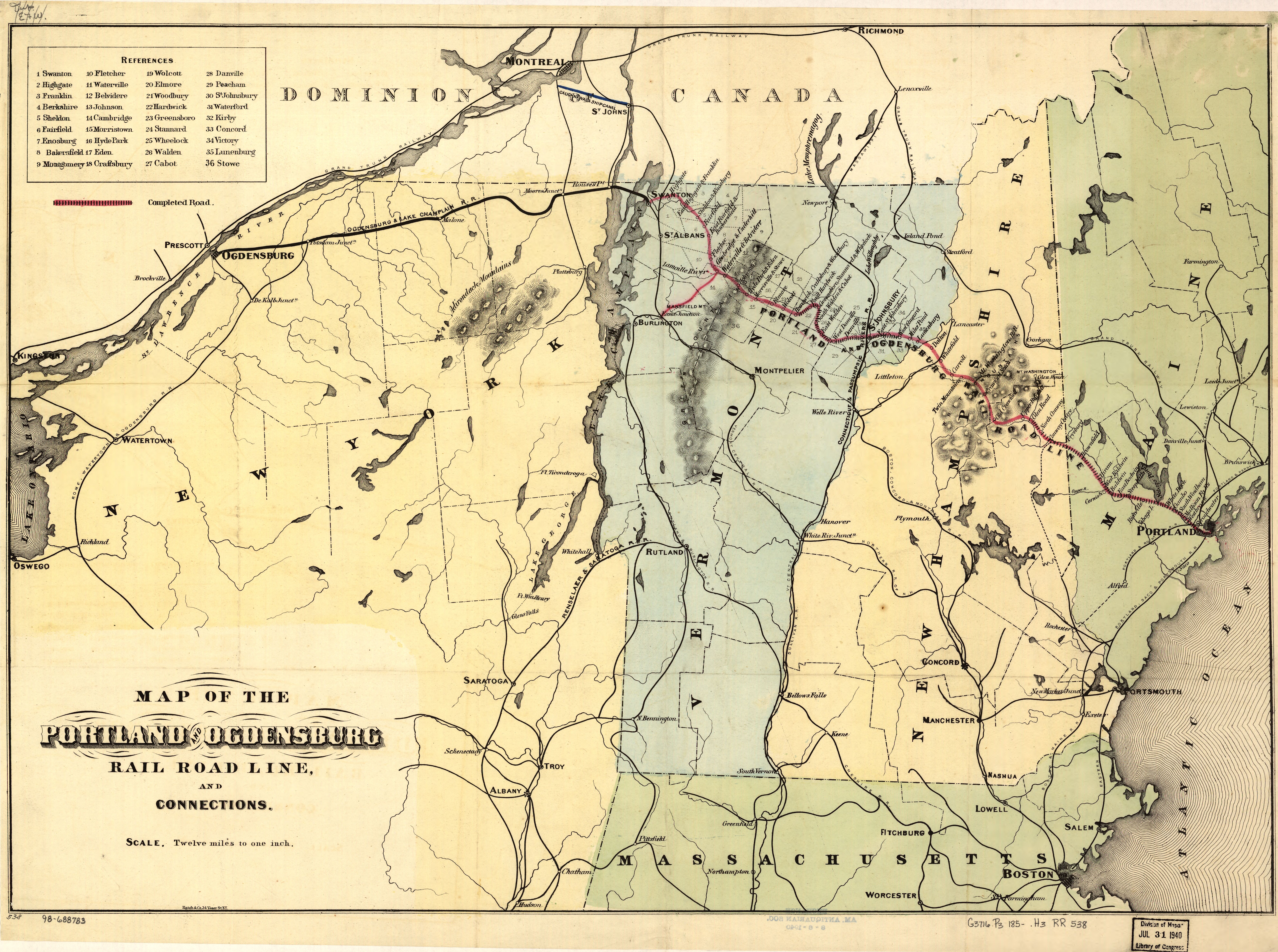
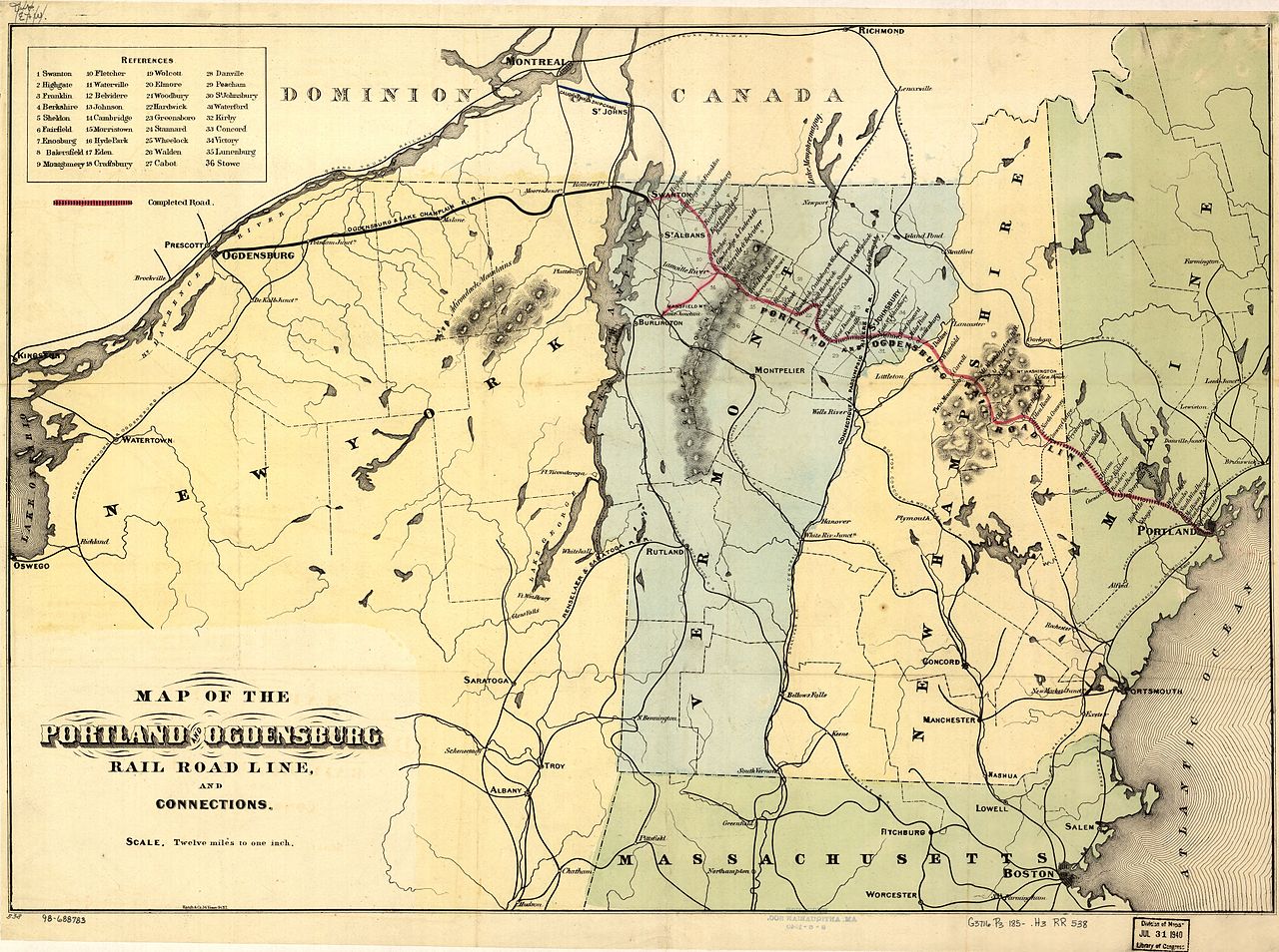
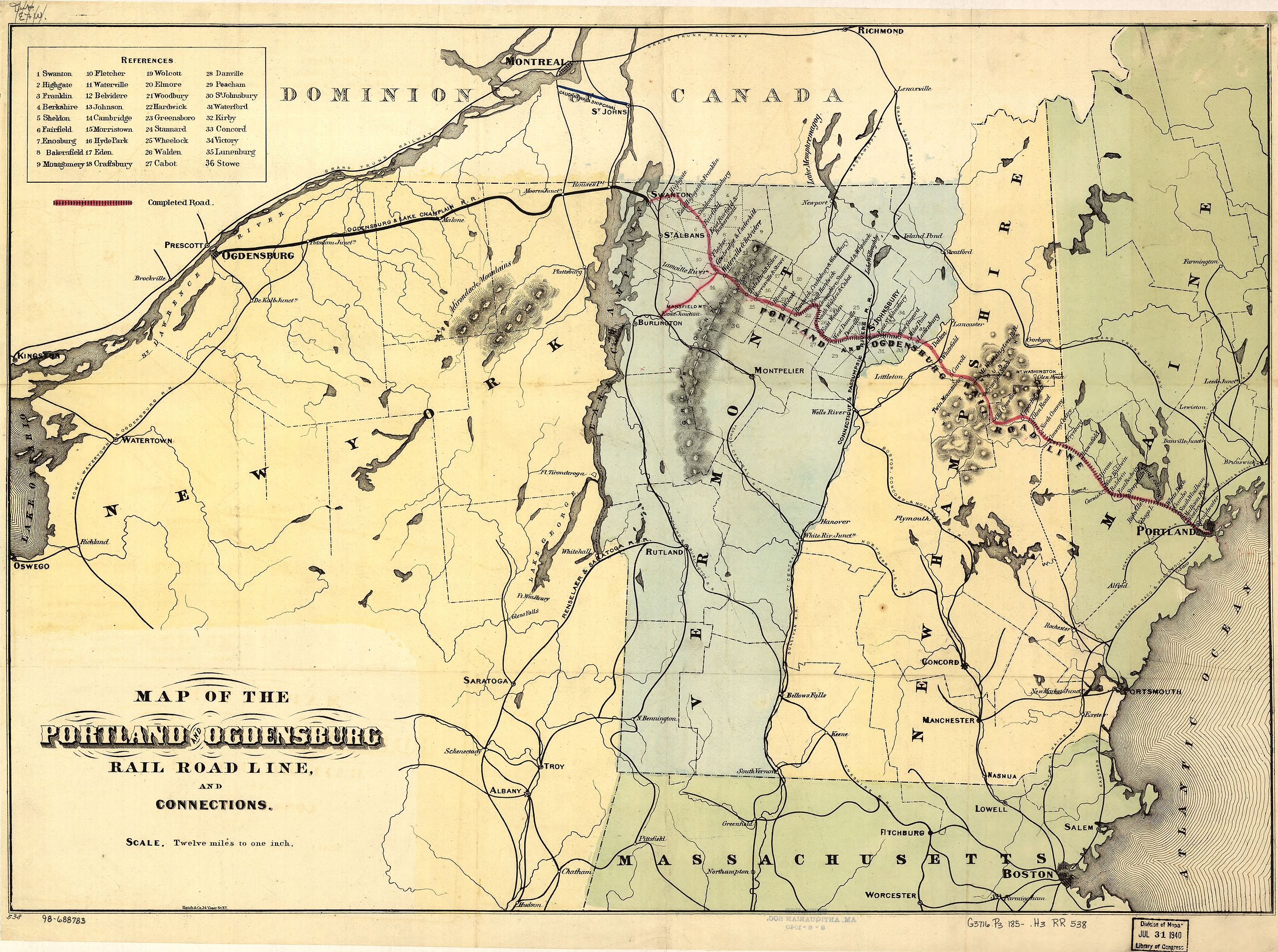
Map of the Portland and Ogdensburg Rail Road from [1]. That claims it's from the 1850s but that's way too early, as the Maine/New Hampshire section was chartered in 1867 and the Vermont section was formed in 1875.
File history
Click on a date/time to view the file as it appeared at that time.
| Date/Time | Thumbnail | Dimensions | User | Comment | |
|---|---|---|---|---|---|
| current | 15:03, 26 July 2005 | | 7,942 × 5,917 (6.66 MB) | SPUI~commonswiki (talk | contribs) | {{PD}} 1850s map of the Portland and Ogdensburg Rail Road from [http://memory.loc.gov/cgi-bin/query/r?ammem/gmd:@field(NUMBER+@band(g3716p+rr005380))]. category:Maine Central Railroad category:railroad maps |
You cannot overwrite this file.
File usage on Commons
There are no pages that use this file.
File usage on other wikis
The following other wikis use this file:
- Usage on de.wikipedia.org
- Usage on en.wikipedia.org
- Usage on en.wikivoyage.org
- Usage on www.wikidata.org